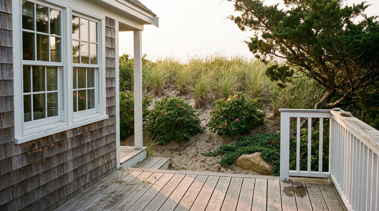
Lake Michigan Shoreline Restrictions That Shape Building
August 20, 2026
August 20, 2026
A buyer walks a bluff lot in Saugatuck or South Haven, stands where the future great room will sit, and mentally furnishes the whole parcel. Then the survey comes back, the zoning administrator pulls the shoreline overlay map, and half the lot they were planning around turns out to be unbuildable. Not because of the price. Because of a line that has nothing to do with the property boundary at all.
That line is the real story on Lake Michigan's West Michigan shore right now, more than median price or days on market. Two lots that look identical from the water can carry completely different building rights, and the line that decides it moves every time the shoreline does.
Michigan's Department of Environment, Great Lakes, and Energy designates stretches of Great Lakes shoreline as High-Risk Erosion Areas when the land has been receding at a foot or more per year over at least 15 years. Once a parcel falls inside one of those zones, a permit is required for construction on any portion of the property, regardless of how far back from the water the project sits.
Here is the part that catches people off guard. The setback isn't measured from your property line or even the water's edge. It's measured from the erosion hazard line, which is usually the top of the bluff, and EGLE calculates two different setback distances from that point: a 30-year line for structures built to be readily moveable, and a longer 60-year line for septic systems and larger permanent construction. A bluff over 25 feet tall can shift that distance further. On paper you own a deep, wide lot. On the ground, the buildable envelope can be a fraction of what the parcel size suggests.
Here's where it gets specific to this market. South Haven sits inside two different local governments that regulate the same beach differently. The City of South Haven's zoning ordinance took effect January 1, 2025, and includes a High-Risk Erosion Overlay Zone layered on top of its waterfront business and residential districts. Just outside city limits, South Haven Charter Township runs its own Shoreline Protection Overlay District, which applies within 500 feet of the 1986 Record High Water Mark and can push required setbacks to 50 or even 100 feet from that line, with a land use permit required before construction, earth moving, or vegetation removal begins.
A lot that looks the same from a boat can sit under either rulebook depending on which side of a boundary line it falls on, and that boundary rarely shows up on a listing photo. Before a buyer gets attached to a specific parcel, the first real question isn't the asking price. It's which government has jurisdiction over that piece of ground.
Saugatuck Township gave a preview of where this is heading. After a four-month moratorium on lakeshore building and zoning permits, the township board approved a new Lakeside Overlay District Ordinance on April 9, 2025, and the rules took effect April 24, 2025, covering every property west of Lakeshore Drive between the township's northern and southern boundaries.
The ordinance does more than layer a setback on top of existing zoning. It caps lot coverage at 40 percent of the buildable area, bans basements outright in favor of crawlspaces or pilings, sets the waterfront setback at the 60-year erosion recession line rather than the shorter 30-year line, and prohibits fences, in-ground pools, and underground irrigation in the waterfront yard. Driveways have to be permeable. Earth-moving is restricted to within 10 feet of the building footprint. Native dune grass has to go back in wherever it's disturbed.
"We recognize the fragile environmental conditions happening along the Lake Michigan shoreline," said Township Manager Daniel DeFranco when the ordinance passed. The township is hoping the approach spreads to neighboring lakeshore communities facing the same erosion pressure, which means a buyer comparing lots today in Saugatuck, Douglas, or South Haven could be comparing very different sets of construction rules within a few miles of shoreline.
Buyers often treat current water levels as the whole picture. That instinct got tested hard this year. Lake Michigan's monthly mean water level dropped below its long-term average in October 2024, the first time that had happened in a decade, and stayed below average clear into the spring of 2026. Then the lake staged a sharp reversal. Following an unusually wet April across the basin, Lake Michigan-Huron rose 13.4 inches that month alone, a record jump for April since water level tracking began in 1918, roughly triple the typical seasonal rise. By late May 2026, levels were running slightly above the long-term average for that time of year and seven inches higher than the same point in 2025.
That swing matters because erosion risk on this coast isn't tied to where the lake sits today. It's tied to how far it can move in a season, and 2026 just demonstrated that the range is wider and faster than the recent low-water years suggested. A buildable envelope calculated during a calm stretch can look very different two years later, which is exactly why the setback lines are drawn from long-term recession rates rather than the current shoreline.
The financial stakes behind these rules aren't abstract. When water levels climbed sharply between 2015 and 2020, property owners along this stretch of coast who tried to hold their bluffs in place with seawalls and stone revetments were paying in the range of $2,000 to $3,000 per linear foot of shoreline for that protection. Major bluff failures, where the erosion outran the armoring, have run property owners $200,000 to $300,000 on a single lot once engineering, permitting, and reconstruction are added up. In shared-shoreline communities, homeowners associations have passed capital assessments on top of regular dues to fund that kind of work, in some cases running well into four figures per quarter for years at a stretch.
That risk is also priced into the dirt itself. Lake Michigan frontage in this part of the state can run anywhere from roughly $5,000 to $40,000 per foot, and the spread has less to do with square footage than with three things: whether the beach is actually usable at the base of the bluff, how stable that bluff has been, and whether the parcel already carries erosion control that's documented and permitted. An automated estimate can't see any of that. A walk of the property, a look at the erosion hazard line, and a conversation with the local zoning office can.
Standard homeowner's insurance typically excludes damage from shoreline erosion, which surprises buyers who assume a normal policy covers whatever the lake does to the yard. Separately, many Lake Michigan parcels fall inside FEMA-designated flood zones, which triggers a mandatory flood insurance requirement for any federally backed mortgage whether the buyer wants the coverage or not. Getting a flood zone determination and an insurance quote for the specific parcel early in due diligence, rather than after an offer is accepted, changes the real cost of ownership before it's locked into a contract.
Does the setback apply to the whole lot or just the part closest to the water? The permit requirement applies to construction anywhere on a designated High-Risk Erosion Area parcel, even portions set well back from the bluff. The setback lines determine where a house, addition, or septic system can sit, but the permit obligation isn't limited to the shoreline edge alone.
What if the existing house is already inside the setback line? Existing structures aren't required to move to meet current setbacks. Future additions or substantial reconstruction, however, will need an EGLE permit and will be evaluated against the current lines, which is worth knowing before budgeting for a renovation on an older lakefront home.
Is South Haven the only place with split jurisdiction like this? It's the clearest local example, but overlay rules vary township by township along this coast, which is exactly why the jurisdiction question comes before the price question on any shorefront parcel here.
The lake doesn't ask what your closing date is. The rules that govern what you can build on it are drawn from decades of shoreline movement, not the calm week you happened to view the property. If you're weighing a lot in Saugatuck, South Haven, or anywhere along this stretch of coast, I'd rather walk the setback map with you before you fall for the view. Reach out to Tony Hernandez or start with your free home valuation if part of the plan involves selling first.
Stay up to date on the latest real estate trends.



Get assistance in determining current property value, crafting a competitive offer, writing and negotiating a contract, and much more. Contact me today.